Johns River Fishing Spot
- Public Fishing: Yes
- Shoreline: 14'
- Website: http://en.wikipedia.org/wiki/Johns_River_(New_Hampshire)
- Last Modified By: carpmaster on 09/02/09 09:47 PM
- Ask about Johns River in our Fishing Forums
Photos
Fish Species
Johns River Description
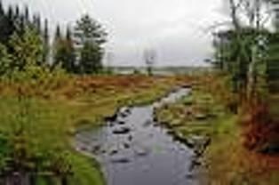
The Johns River (also called "John's River"), in northern New Hampshire, arises at Cherry Pond in Jefferson and runs approximately 14 miles (23 km), generally northwest, to the Connecticut River. It passes through Hazens Pond, near the Mount Washington Regional Airport, traverses the town of Whitefield, where it is crossed by U.S. Highway 3, and then crosses the town of Dalton before joining the Connecticut. The river basin drains numerous small ponds, including Martin Meadow Pond, Weeks Pond, Weed Pond, Clark Pond, Burns Pond (formerly Long Pond), Richardson Pond/Marsh, Hazens Pond, Cherry and Little Cherry Pond, Forest Lake and Mirror Lake (formerly Blake Pond). Tributaries include Chase Brook, Carroll Stream, Bear Brook, Leonard Brook, Cherry Mountain Brook, Carter Brook and Bog Brook. The watershed area is bounded by the eastern slope of the Dalton Mountain Range, the southern slope of Mount Prospect and the western slope of Cherry Mountain (also called Mount Martha).